Village map of Landal Callantsoog
The park map and site plan of Landal Callantsoog is not only very useful during your stay, but especially when booking. The map gives a clear overview of the available facilities and the location of the accommodations on the park. TIP: Book with preferred location and choose a cottage close to the main facilities.
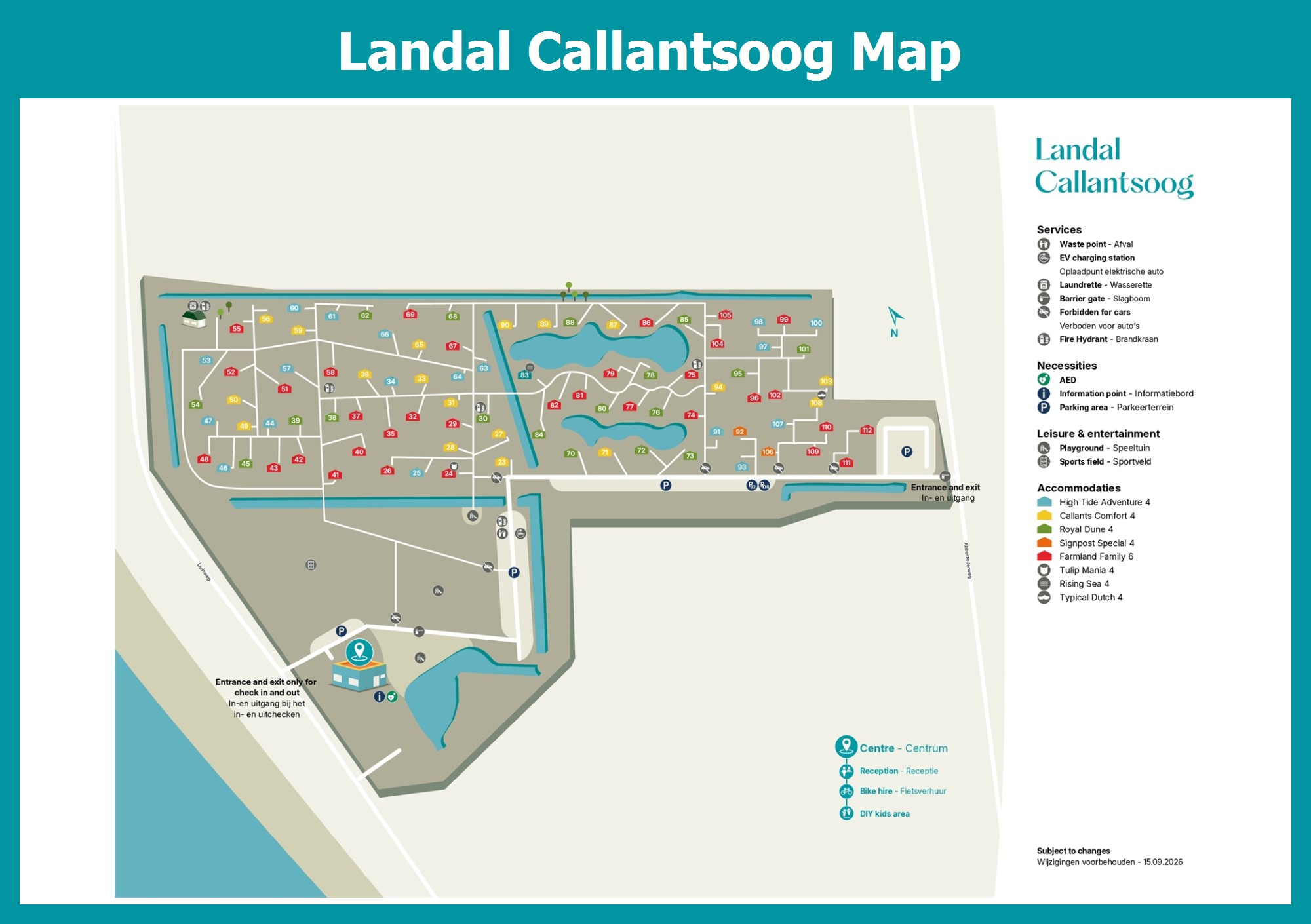
Right in the dunes of Callantsoog, just a 500-metre walk from the beach, lies Landal Callantsoog: a car-free park with modern lodges, away from the crowds. The layout of the park follows the dune landscape, and the park map shows where the lodges sit among the dunes and where the facilities are, such as the grand café, the supermarket, the snack bar, the outdoor playground, the laundry and the bike rental. You stay in a lodge for four people, such as the Callants Comfort, the High Tide Adventure, the Royal Dune or the Signpost Special, or in the Farmland Family for six. Every lodge has a veranda for a relaxed start to the day. Tip: look at the location of accommodations and facilities on the site plan; to reach the beach quickly, pick a lodge near the path to the beach, and with children a spot near the playground is handy. Pets are welcome and wifi is free. Walk through the Zwanenwater dune area, visit Fort Kijkduin or enjoy the terraces in Callantsoog's small centre.